

Los Angeles to Death Valley Drive – 2-Day Road Trip Itinerary
Table of Contents
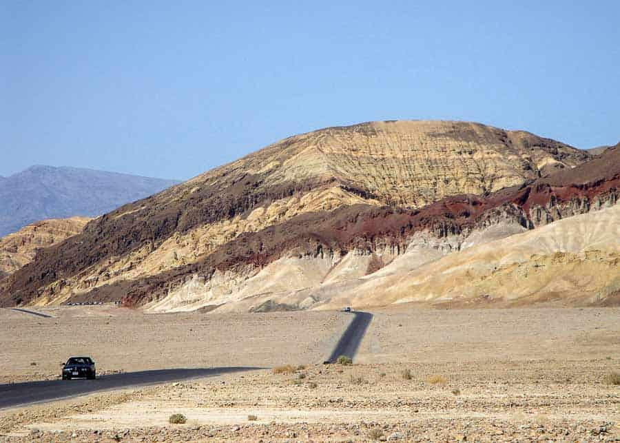
If you were to judge it by its ominous name, you’d probably never want to visit a place called Death Valley. But don’t let the name put you off. For those who like the desert, Death Valley is a fascinating place to visit and one of the few National Parks close to L.A. So, if you decide to tackle the drive from Los Angeles to Death Valley, this post will provide you with an itinerary all the information you need in order to plan your trip.
How to Drive from Los Angeles to Death Valley
The drive from Los Angeles to Death Valley takes about 4.8 – 5 hours, which is why most people visit the park on a weekend trip.
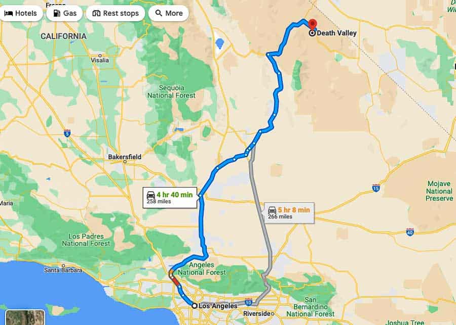
There are two main routes to Death Valley. Both are scenic and both require about the same amount of time.
• The eastern route takes Interstate 10 or 210 to Interstate 15 north to Baker, then California 127 to California 190 west into the park.
• The western route takes Interstate 5 to 210 to California 14, then U.S. 395 to California 190 west into the park.
Depending in which neighborhood you stay in L.A., you can take one or another. If you are starting from the west side of the metro area (Hollywood, Beverly Hills), or anywhere west of Pasadena, the west approach to Death Valley on Hwy 14 to 395 is the best for you.
One other option is to approach Death Valley from one side and leave from the other. This will give you the possibility to experience both routes.
There may be other ways to drive from L.A. to Death Valley, but my advice is to choose one of the two routes mentioned above. They are not only shorter, but they also offer the possibility of making really interesting stops along the way.
Where to Stop When Driving from Los Angeles to Death Valley
The drive from L.A. to Death Valley passes through some very picturesque areas. You may not be able to stop at each one of them, but here are your options, in case you want to add some extra sites to your Death Valley itinerary.
Route 66
If you never saw the historic Route 66 before, I suggest to drive a short urban piece of old Route 66 – which is called Foothill Boulevard – as it goes through Claremont and Rancho Cucamonga (30 miles).
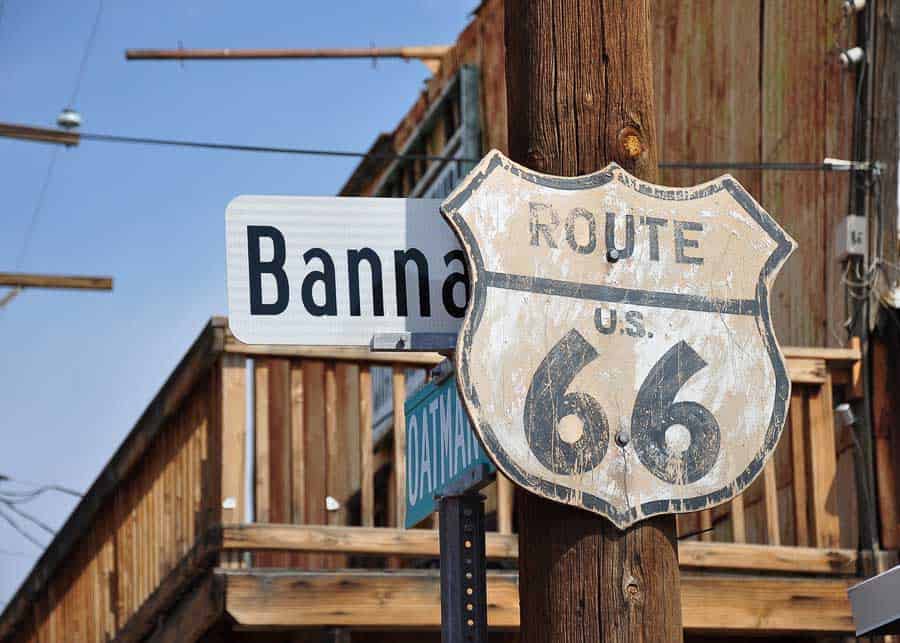
Affectionately called the “Mother Road,” this 2,400-mile route was the first continuously paved highway linking Chicago and Los Angeles. Driving even a small part of it is a fun experience.
Calico Ghost Town
If you have time for a short detour from I-15 you can visit the ghost town of Calico, which is a few miles east of Barstow.
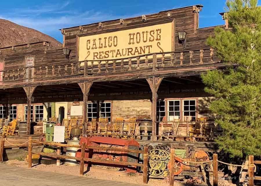
Ghost town devotees may argue that Calico is touristy and over-commercialized, but if you never saw a ghost town before, Calico may be a fun place to visit.
Vasquez Rocks
If you drive the western route to Death Valley (via California 14 freeway), between the cities of Santa Clarita and Palmdale you’ll see the big slanted stones of Vasquez Rocks.
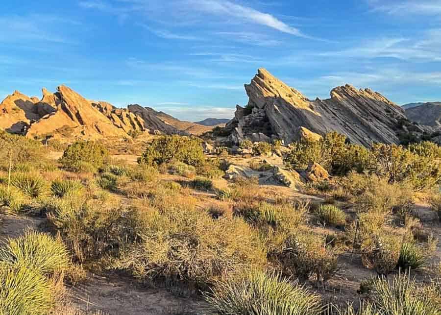
If this landscape looks familiar, it’s because Vasquez Rocks have been used as a filming location for many western movies. The park is free to visit. If you decide to stop at Vasquez Rocks, take the Agua Dulce exit from the Fwy 14.
Red Rock Canyon State Park
Also on Hwy 14, about 20 miles north of Mojave Desert, is Red Rock Canyon – a small state park along both sides of the highway (not to be mistaken for Red Rock Canyon Natural Preserve in Nevada, west of Las Vegas).
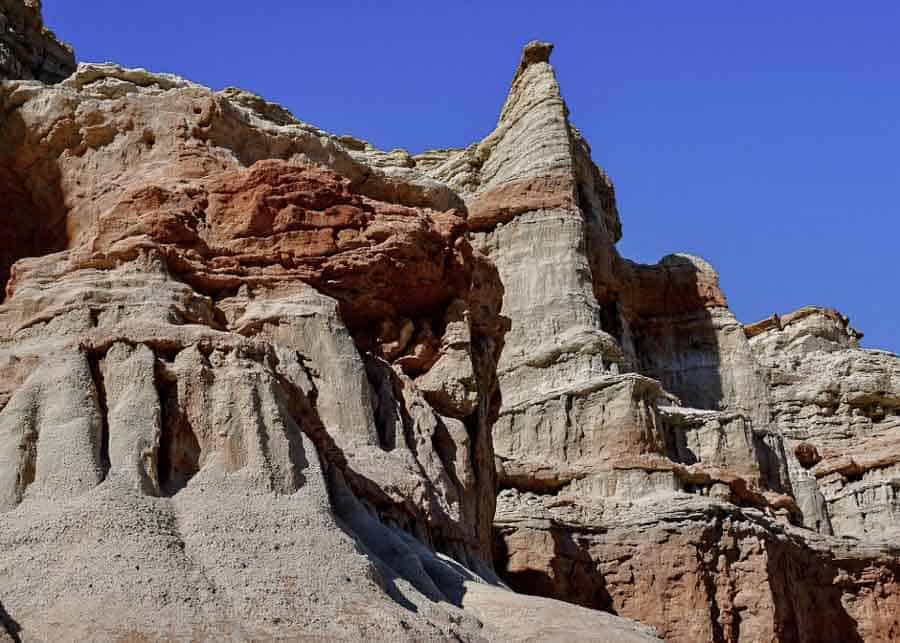
You can see the rocky walls from the freeway, but if you decide to stop and explore some of the rock formations, you’ll probably need about an hour.
Death Valley 2-Day Itinerary
Visiting Death Valley involves a lot of driving, so unless you have a well planned itinerary your 2 days will go by in a flash without being able to see much. In this post I’ll tell you what are the best places to see in Death Valley and how much time you need for each one of them. I will also give you some tips for driving in Death Valley, tell you what is the best time to visit and make some recommendations for the best places to stay while visiting the park.
The points of interested listed below are in the order they come up when you drive to Death Valley from Los Angeles. Seeing them in this order will save you a lot of time. Of course, you may choose to visit some and just skip others, depending on your available time and interests.
Day 1 Itinerary
Darwin Falls
When you drive to Death Valley from Los Angeles, the first point of interest you’ll come across is Darwin Falls. The falls are located on the west side of the park, about 5-6 miles before the entrance. This is an easy hike that takes a little under an hour to complete.
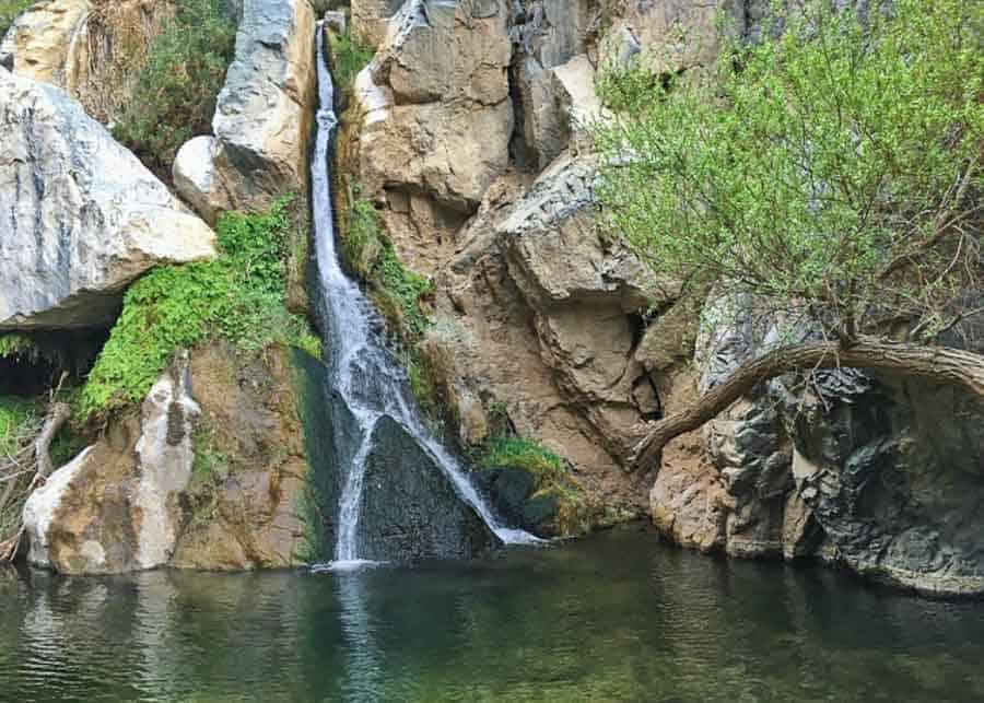
Darwin Falls is an unexpected oasis in the middle of desert and it’s the only stop on your Death Valley itinerary where you’ll see water.
The dirt road that leads to the falls is lovely and quite short (2.5 miles). It may surprise you to see so much vegetation in the middle of the desert, but places like this are not unique in California. If you hike along the Mojave River, in the San Bernardino Mountains, you will discover another oasis like this at the Deep Hot Springs.
Father Crowley Overlook
Father Crowley Vista is located 7.5 miles west of Panamint Springs along Highway 190 near the western boundary of the Park. This is a good place to stop and enjoy a panoramic a view into Rainbow Canyon. Time needed: 10-15 minutes.
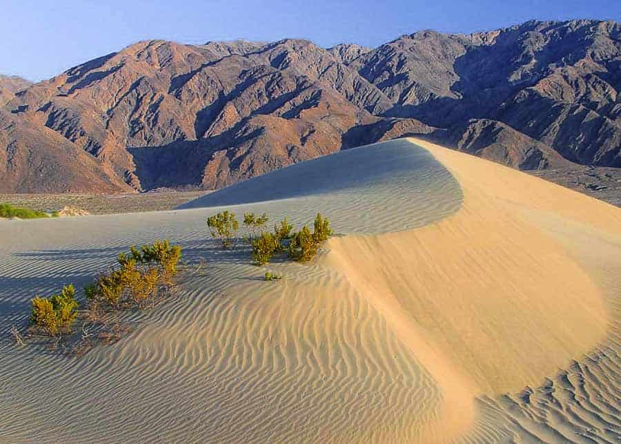
Mesquite Sand Dunes
These are not the tallest dunes in Death Valley, but they are very easy to access (right on Hwy 190, close to Stovepipe Wells). The highest dune (which is about 1 mile from the parking lot) rises only 100 feet. Although not very high, it may still look impressive if you get close enough to it.
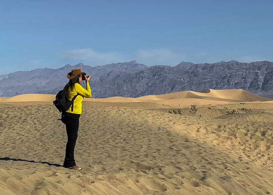
You should stop here and take a short hike on the dunes, just for the experience. Walking on sand is a bit of a challenge, so don’t get carried away. Save your energy to walk back to the car. Time needed: 50-60 minutes.
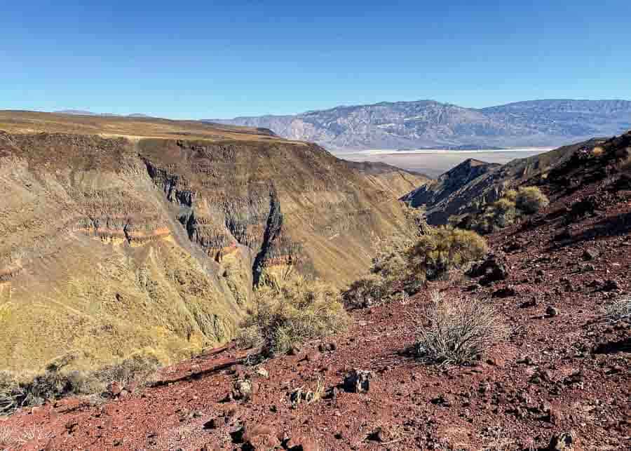
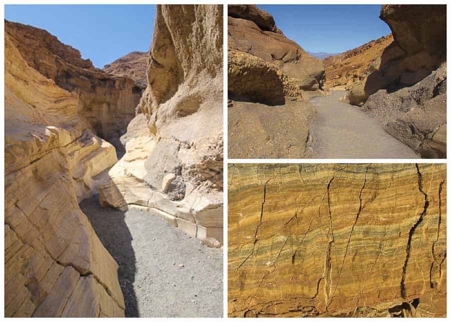
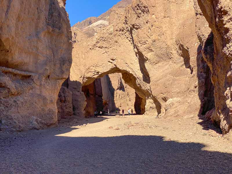
Mosaic Canyon
This is a really beautiful hike which we just discovered on our latest visit to Death Valley. The 1.7 miles trail ends at a steep (dry) waterfall. It’s a beautiful canyon, and even though there were some tricky, steep, parts, the hike is not particularly challenging.
We took our time to take photos and made it in and out in 3 hours. But you could easily go faster if you want to.
Harmony Borax Works
Harmony Borax Works are the ruins of an old borax ore-processing plant in Furnace Creek Springs. Borax was the “white gold” of the desert, an ingredient used in laundry detergents and in the production of fiberglass.
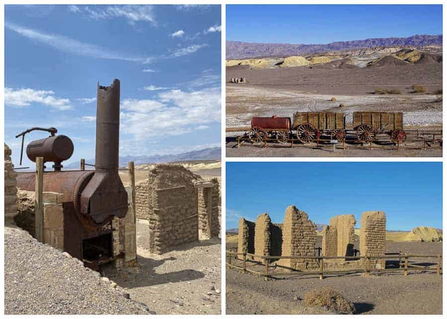
The 0.4 miles Interpretive Trail shows the remains of a building and a well-preserved 20-mule team wagon (minus the mules). It’s not much to see, but it’s still an interesting stop to add to your Death Valley itinerary. Takes 10-15 minutes to visit.
Badwater Basin
From Furnace Creek Indian Village continue on Badwater Road to visit the Badwater Basin. This point lies 282 feet below sea level, which is the lowest dry elevation in North America. You can’t really appreciate how vast this salt flat is until you get there and look around. It seems to stretch for miles!
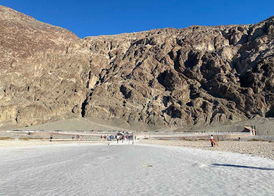
Take a stroll for as long as you want and then turn back. That’s about all you can do in this place. It takes 15-20 minutes to visit, depending on how far you want to walk on the salt flat. Parking is really tight here, but you can also park on the side of the road if there is no space available.
Devil’s Golf Course
From Badwater Basin turn around and stop at the Devil’s Golf Course, which is just a few miles back on the same road that you came. This area is not particularly spectacular, but it’s worth stopping just to see what strange forms salt can take sometimes.
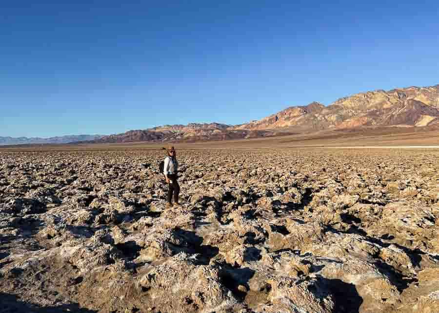
I can’t think of a more dreadful and inhospitable scenery than the lumpy salt flats at Devil’s Golf Course! It looks really desolate. These formations can be surprisingly sharp, so be careful when stepping on them. You only need 10-15 minutes at the most here.
Artist’s Drive & Artist’s Palette
After Devil’s Golf Course continue to the Artists Palette. Access to the Artist’s Drive is off Badwater Road. The drive itself is 9 miles long and is only one way. That’s why it makes more sense to do it on the way back from the Badwater Basin.
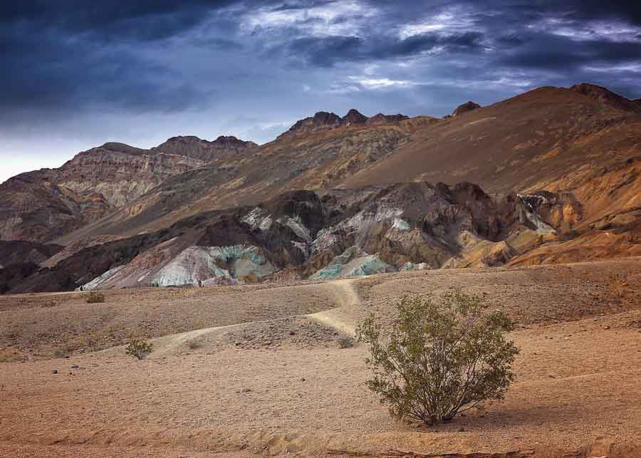
Along the road there are places where you can park your car and hike to see the rock formations. The drive itself takes about 30 minutes, but if you want to hike it may take longer.
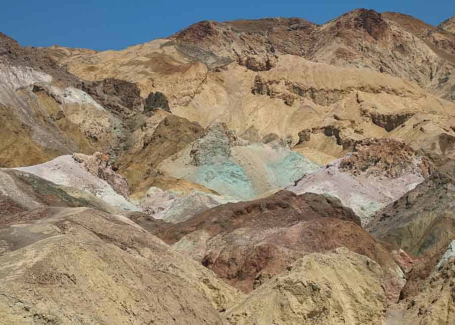
The scenery here is absolutely spectacular, so should at leasts to to take pictures. Artist’s Palette was one of the filming locations for the movie Star Wars.
The Natural Bridge
This is a short 1 mile hike (each way) located only 10 minutes away from Badwater Basin.
The Natural Bridge is the perfect spot for a photo-op as you’ll be underneath a stunning 50 foot tall bridge. If you only want to take a few shots, it takes about 10-15 minutes to reach the natural bridge from the parking lot.
The trail is fairly flat, with a minor uphill walk through the canyon. After about a mile you’ll see a large boulder lodged in a narrow part of the canyon. This trail is usually crowded, but is well worth a stop.
Day 2 Itinerary
Your 2nd day itinerary includes some farther away places to drive to in Death Valley. The hardest to reach is Racetrack Playa. If you decide not to drive all the way to it, you should at least go to Ubehebe Crater.
Zabriskie Point
Start your day with a stop at Zabriskie Point, which is located on Highway 190 (about for 4 miles southwest of Furnace Creek.) This is one of the greatest spots for photography in Death Valley, especially at sunrise. As the sun goes up, you’ll witness a truly amazing palette of colors that changes very fast.
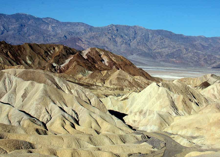
The viewing platform is only a short walk from the parking lot. But try to get there early, as the place gets packed with with photographers trying to snap a good shot. Time needed: 15-20 minutes.
Dante’s View
From Zabriskie point, continue for another 12 miles on 190 till you reach Dante’s View parking lot. Dante’s Vie is considered one of the most scenic viewpoints over Death Valley. I highly recommend stopping here because you’ll get a great perspective of the entire area, as well as amazing views of the Badwater Basin.
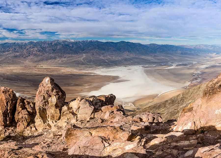
If you only want to take a few shots and admire the valley, you probably won’t spend more than 15 minutes here.
Ubehebe Crater
From Dante’s View turn around to go to Ubehebe Crater. The crater is located in the far north end of Death Valley, on a spur road off CA 190, just before the highway turns east and exits the park near Scotty’s Castle.
This is 30-40 miles drive from Furnace Creek, which takes roughly 45 minutes. Although it’s a longer drive, I think it’s worth doing because Ubehebe is one of the most interesting places to visit in Death Valley.
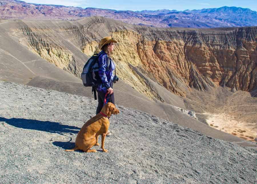
Some people hike down into the crater, but coming back up requires a lot of effort. So if you don’t feel up to it, you can just hike around the crater. Or you can just admire the crater from the platform next to the parking lot. Time needed: 15-20 minutes (if you don’t hike down into the crater).
Racetrack Playa
From Ubehebe Crater you can continue to the Racetrack Playa to see the “Sailing Rocks.” However, keep in mind that this is one of the most difficult places to reach in Death Valley so, if you decide to drive here, you’ll need a 4×4 vehicle with high clearance.
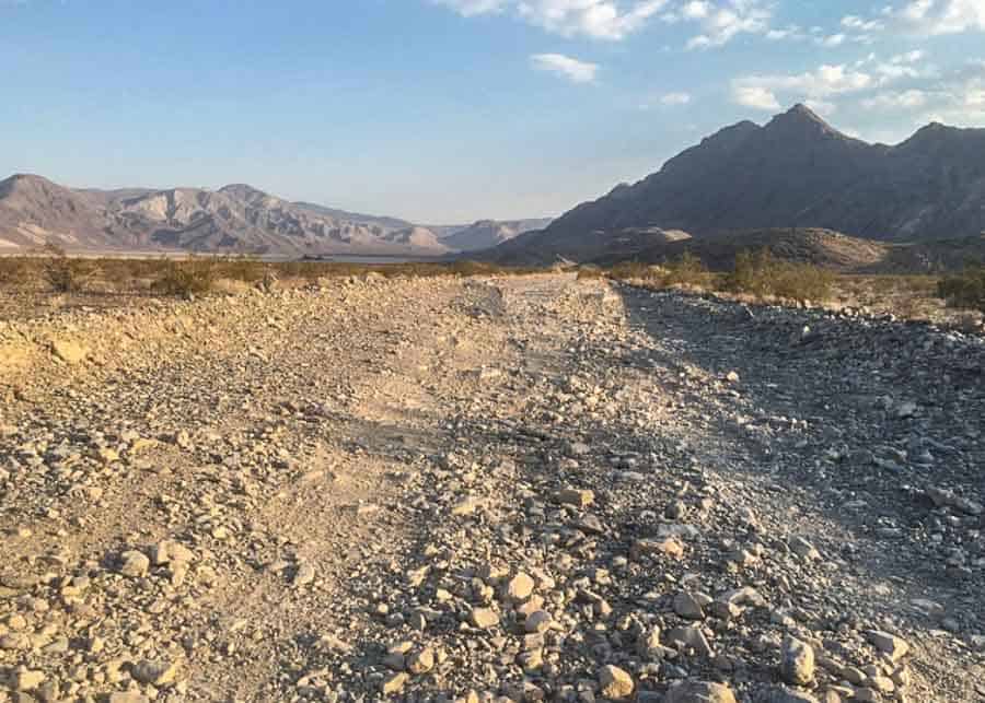
The only way to get there is via a rough, rocky road covered with gravel and sharp rocks, that passes though a very remote area. Flat tires and accidents are very common on this road.
The road is 27-miles long and takes roughly 2.5 hours to drive (one way.) But once you get there, the scenery is absolutely amazing.
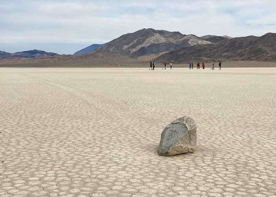
Racetrack Playa is a very interesting place to visit, but getting here is a challenge and it’s not for everybody. You’ll have to decide for yourself if you want to put up with all the dust and the difficulty to drive there in order to see the moving stones.
More Than 2 Days in Death Valley?
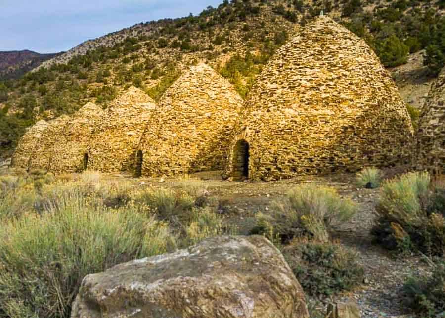
If you have more time to spend in Death Valley, you can expand your itinerary to include some other sites, like the Charcoal Kilns, Scotty’s Castle (temporarily closed now), Grotto Canyon Hike, Eureka Sand Dunes, or Telescope Peak Trail.
Tips for Driving in Death Valley
- Death Valley is a HUGE park, so expect to do A LOT of driving between the points of interest.
- There are very few gas stations in the Park and the prices are double than anywhere else in California. Even so, fill up your tank whenever you come across a gas pump.
- There is no GPS or cellular service in Death Valley, so we recommend bringing a map with you.
- We recommend buying a good Death Valley Map, since the ones provided by the Visitors Center are very sketchy.
- Internet is unusable in Death Valley. Some hotels offer free WiFi, but the signal is too weak.
- Entrance Fee for the Park is $30/vehicle (valid for 7 days) and can be paid at any of the park entrances or pay stations.
Best Time to Visit Death Valley
Death Valley is one of the most popular National Park in the United States and it’s open year round. However, by May the valley is too hot for most visitors. Nonetheless, you’ll see people flocking to the park all throughout the hot months of Sumer.

Where to Stay in Death Valley
There aren’t many lodging options in Death Valley, so expect to pay a lot if you want to stay the park (between $370-$580/night). The only hotels available are: the Ranch at Death Valley, the Inn at Death Valley, and Stovepipe Wells Village.
The first time we came from Los Angeles to Death Valley we stayed at Amargosa Opera House Hotel, at the Death Valley Junction. This is a modest hotel, but with a very interesting history. Even if you don’t stay there, the hotel it’s worth visiting for its strange Spanish style Opera House, dating back to 1923. So if you have more than 2 days in Death Valley, I suggest adding this to your itinerary.
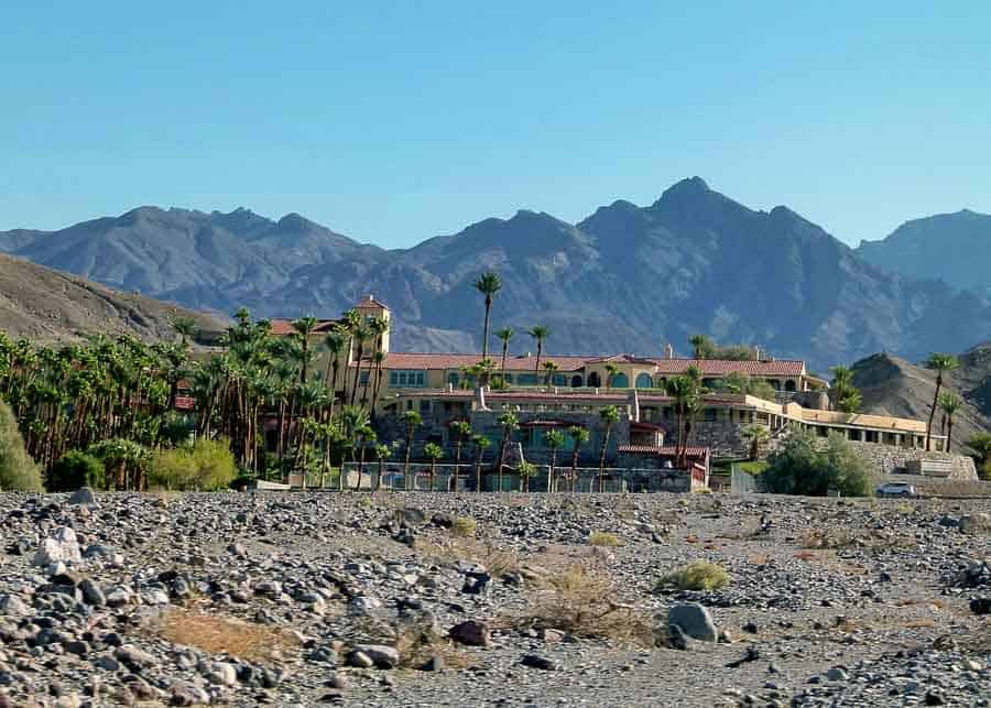
This time we stayed at the Inn at Death Valley and we were very pleased with the level of comfort. Unfortunately, prices were through the roof, but we paid for the convenience of staying in the park and be close to all the attractions.
The hotel has a first class restaurant on the premises, a bar, a large swimming pool, a huge terrace, and a beautiful green park with a pond.
If you found this information useful, please pin it for later:
YOU MAY ALSO LIKE: